You arrive on-site, the sun’s already heating the ground, dust in the air, and a tight schedule ahead. There’s no time for delays, missing cables, or complicated configurations.
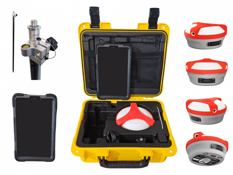
You open a single case.
Inside: a complete, professional-grade surveying system — clean, compact, powerful. You press the power button, and within minutes, you’re collecting accurate data. No guesswork. No scrambling for adapters. Just precision, performance, and confidence.
TerraGenie’s system includes a GNSS receiver with RTK and IMU technologies, a rugged tablet, and a professional-grade survey pole.
Our hardware is built for all field conditions, ensuring centimeter-level accuracy and long-term durability.
Not Just Devices — A Complete Surveying Solution
Every kit comes fully equipped with everything your field team needs to start working immediately — no additional purchases, no complex integrations, no “assembly required.” Whether you’re mapping a dense urban corridor or laying out infrastructure in open terrain, TerraGenie is with you — every step, every stake, every centimeter.