
The TerraGenie kit includes a professional geodetic GPS and a rugged tablet with the TerraGenie software. This system enables users to perform any surveying and marking task—without prior training—and take full autonomous control of construction or development processes with precision.
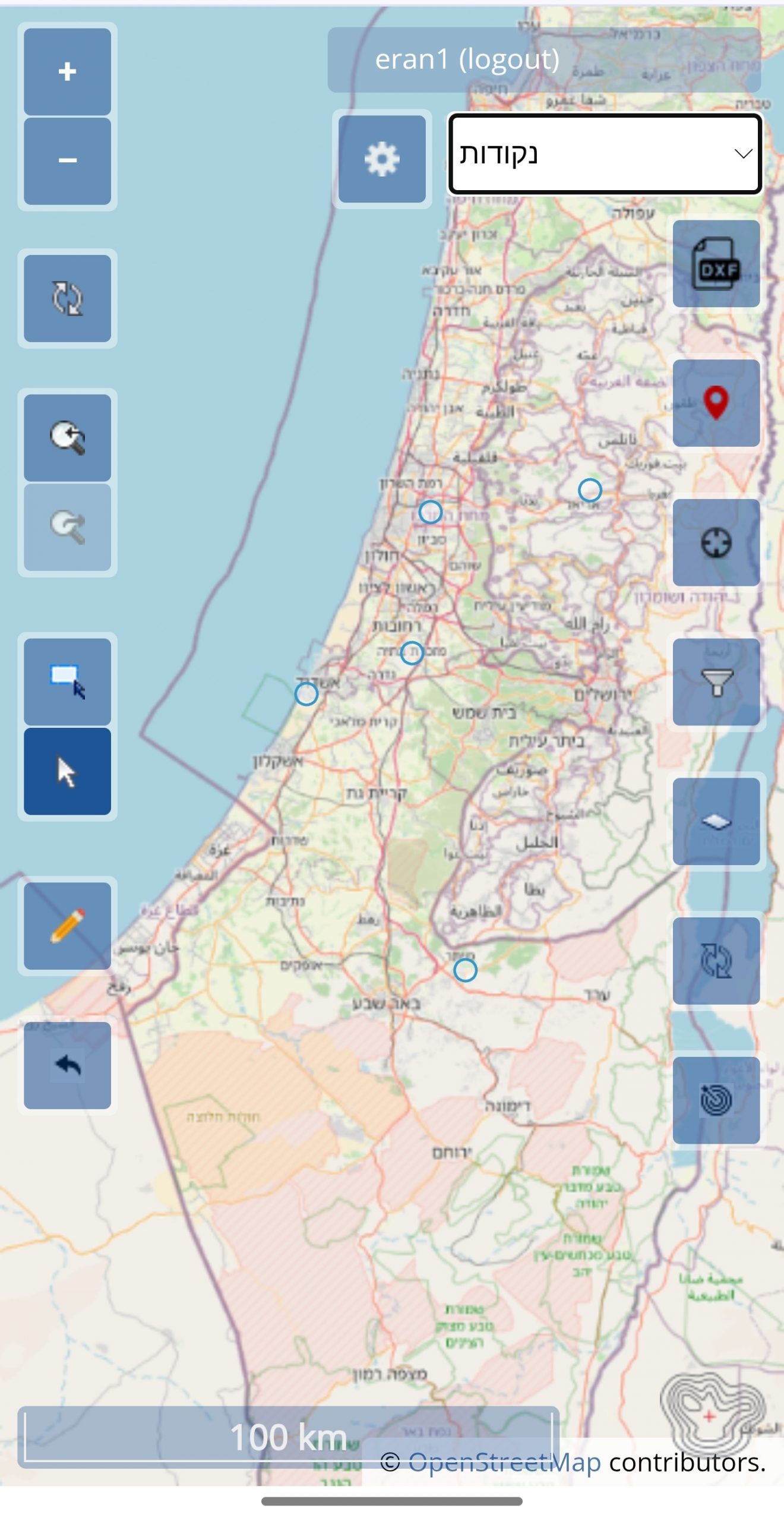
Thanks to TerraGenie’s powerful online capabilities, you can monitor every team in the field in real time, closely tracking the progress and accuracy of data collection.
Multiple users can connect simultaneously from anywhere in the world—measuring, monitoring, and managing site activity live.
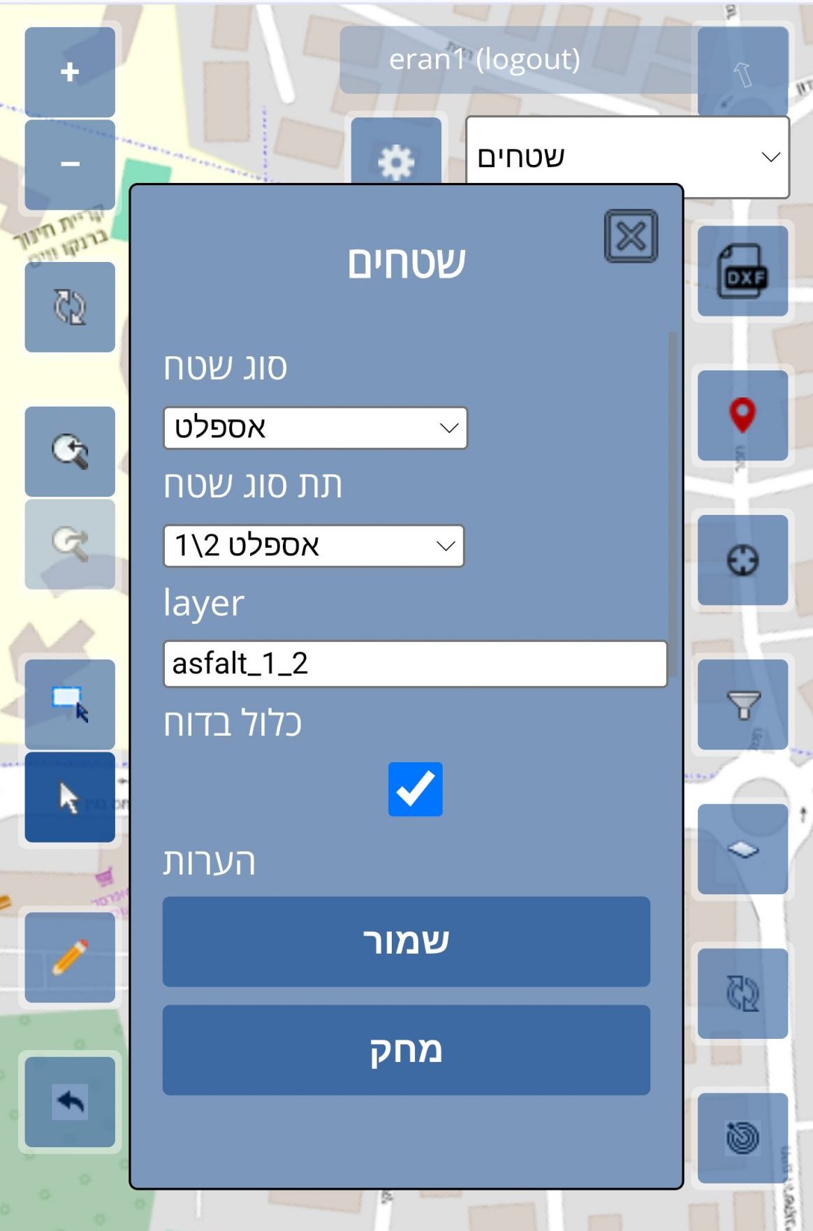
The software handles large AutoCAD files uploaded in the background and overlays the collected data directly onto CAD or orthophoto maps, providing a practical and clear view of the work as it happens.

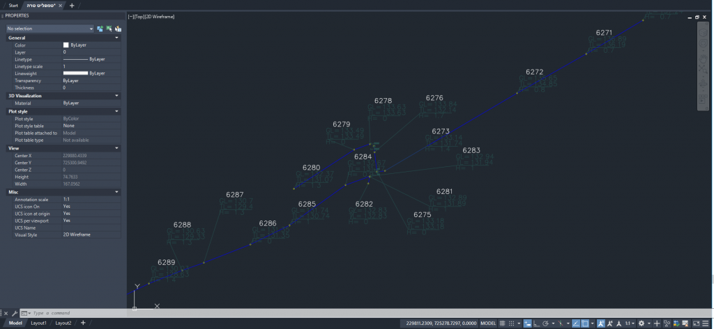
The images demonstrate how the automatic drawings appear once exported to AutoCAD—all field data is drawn automatically using the client’s own blocks and attributes.
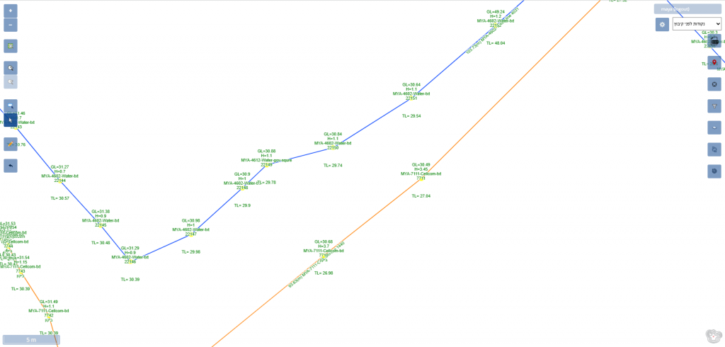
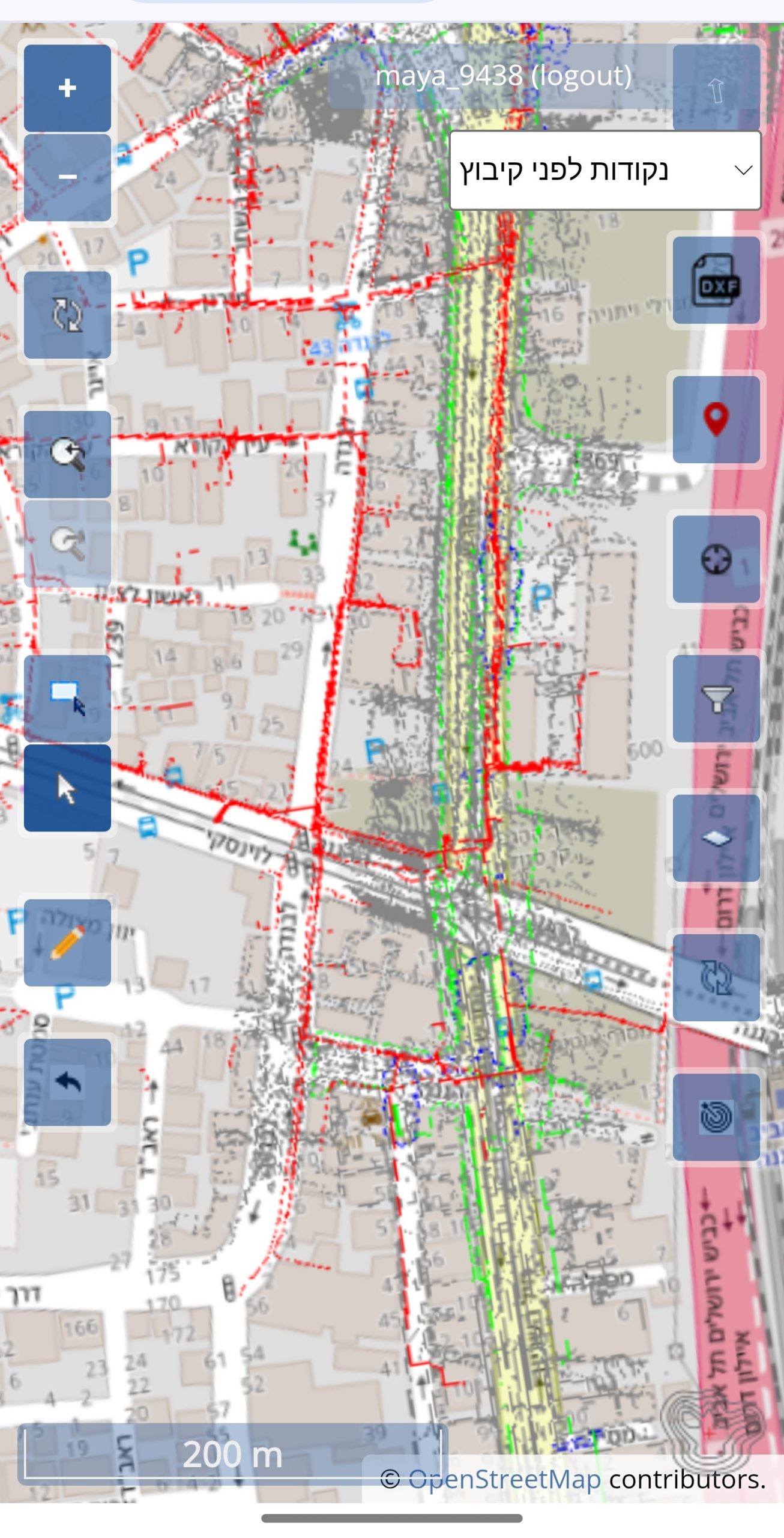
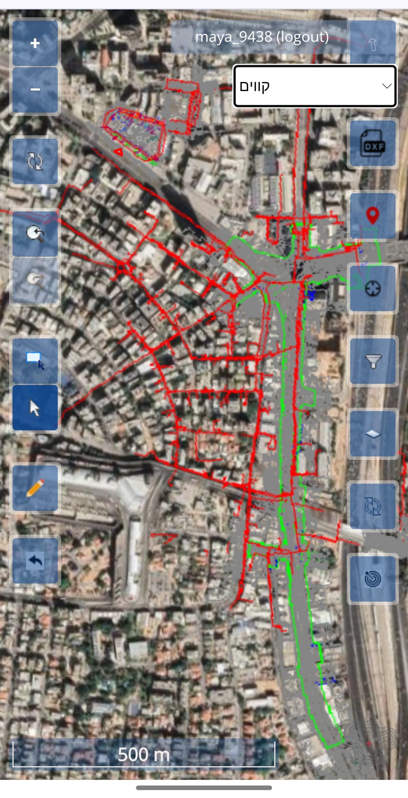
The images demonstrate what the surveyor views and inputs in the field—the background displays the client’s AutoCAD drawing.
Terra-Genie empowers civil engineering contractors to handle tasks traditionally reserved for professional surveyors, such as:
At TerraGenie, we understand that every project and organization operates differently. That’s why we customize the software interface to fit your specific needs, workflows, and organizational structure. Whether it’s adapting features, simplifying processes, or integrating seamlessly with your existing systems, we work closely with you to ensure the platform aligns perfectly with how your team works—making your operations smoother, faster, and more efficient.
Everything is online, with no delays in the flow of data, measurements, or files between the office and the field. The field sees the office, the office sees the field — all in real time.
Following a detailed onboarding session with each client, we deliver software tailored precisely to their specific needs.
TerraGenie’s interface makes tasks like marking, measuring, and many others easy and accessible. Even re-marking a lost point can be done by any team member in just seconds, with minimal effort.
Background loading is a game-changer for clients who “walk through the plan or map” in real time—just like using Waze while driving. This feature provides an unprecedented level of orientation and situational awareness.
Regular updates ensure the software keeps improving, with new features and capabilities constantly being added.
Unmatched support and service in the industry, delivered by knowledgeable professionals and experts in their field — available in three languages.
© 2026 Exclusive interior. All Rights Reserved.